YOUR COLLABORATION PLATFORM
Large Scale Geo Model Management and Collaboration System.
WEB-platform for on-the-fly building and administration of large scale geologic models, allowing multiple modellers to work at the same model at the same time and from different locations.
GeoCloud LARCOS
A web-based multi-user platform for building large geological models
LARCOS – is aimed at authorities, geological surveys, states, consultants, and other private companies. Let the system lead you to the next step by allowing multiple users to work on the same geological model simultaneously, and from separate locations. LARCOS is a part of the GeoCloud and integrates directly into GeoScene3D.
LARCOS
OVERVIEW
Managing large geological models is not easy, as projects often involve the creation of intricate and labor-intensive models. Over time, these models become outdated and require updates as new data is collected, and additional geological and hydrogeological knowledge is obtained.
While managing large geological models can be challenging for various reasons, one commonly encountered difficulty is retrieving the original model and its associated data. Furthermore, when intensive mapping is being conducted, its also very difficult for several modelers to cooperate on the same model, which slows down the modeling process. Combined with the GeoCloud Data Management System, very large datasets can be handled and visualized.
Problems like these have been central in the development of LARCOS.
WHY NOT TRY IT YOURSELF?
Do you want to try what LARCOS can do for you?
Large Scale Geological Model Management and Collaboration System
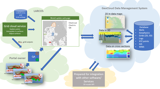
The LARCOS and GeoCloud Data Management Systems are illustrated above. LARCOS is also prepared for integration with other software and services by using API’s.
LARCOS is aimed at authorities, geological surveys, states, consultants, and other private companies. Let the system lead you to the next step by allowing multiple users to work on the same geological model simultaneously, and from different locations.
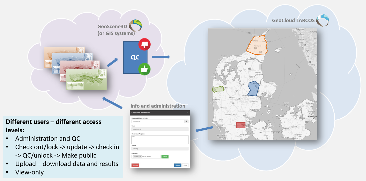
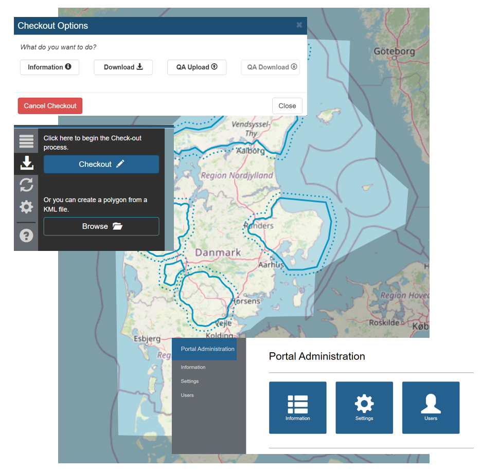
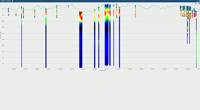
One or more geological models are stored as interpretation points and interpolated grids (layer surfaces) in the GeoCloud LARCOS. Users can check out/lock subareas in a model area, by drawing a region or using a vector file. A point database of the selected area is then generated and sent to the user, including grid files, if they exist in this area.
When an area is checked out, other users cannot work in the same area. A buffer surrounding the locked area helps generating seamless boundaries between neighboring areas. After a user completes modeling in the area, it can be re-uploaded and integrated into LARCOS and the databases behind.
Administration
Administrators of the system controls the user access. They can make quality assurance of the new or updated interpretations and accept model updates before they are released in LARCOS. New, updated grids are generated in the upload phase and made available for the users.
You don’t need an existing layered model to setup and use LARCOS. The system is also useful for organizations just started making geological models, where it, besides the data sharing and visualization opportunities, also will be possible to speed up the entire workflow by allowing several modelers to work on the same project at the same time.
LARCOS is a result of the close cooperation between I•GIS and the Environmental Protection Agency (EPA) in Denmark. LARCOS has reduced the number of hydrogeological public models in Denmark from several hundred to just one single model. LARCOS is constantly being developed and is an integrated part of our GeoCloud Data Management System.
FEATURE
OVERVIEW
Spend your time testing ideas and making the best decisions with streamlined workflows and tools designed for geologists.
PRICING &
SUBSCRIPTION OPTIONS
Our subscription options are flexible and scalable to fit your needs,
providing easy access and reducing costs.
LARCOS is an add-on to our GeoCloud solution. Pricing includes 10 hours of assistance and sparring to setup the basic framework. Price is 10.000€. Yearly subscription is 4.000€.
LARCOS
LARCOS is part of our GeoCloud system. Access to LARCOS is given by the GeoCloud administrator and will be available for an unlimited number of users.
For a demo or looking for further details, please contact us.
REQUIREMENTS
System Requirements
LARCOS is part of the GeoCloud. A subscription to this is required.
More Information
Contact us directly at: supportgs3d@i-gis.dk or stop by our GeoCloud Learning Center to learn more.
DO YOU WANT
TO TRY
Test LARCOS as part of your GeoCloud solution for free. Please contact us for further information
Signup to our newsletter
Receive news about updates, workshops and events sent directly to your inbox!

